


FRUITLAND TWP PCT 2, Muscatine County, Iowa
About
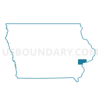
Outline

Summary
| Unique Area Identifier | 582926 |
| Name | FRUITLAND TWP PCT 2 |
| County | Muscatine County |
| State | Iowa |
| Area (square miles) | 6.57 |
| Land Area (square miles) | 6.55 |
| Water Area (square miles) | 0.02 |
| % of Land Area | 99.77 |
| % of Water Area | 0.23 |
| Latitude of the Internal Point | 41.40603410 |
| Longtitude of the Internal Point | -91.11447710 |
Maps


Graphs
Select a template below for downloading or customizing gragh for FRUITLAND TWP PCT 2, Muscatine County, Iowa


Neighbors
Neighoring Voting District (by Name) Neighboring Voting District on the Map
- BLOOMINGTON TWP W/O MUSCATINE Voting District, Muscatine County, IA
- LAKE TWP Voting District, Muscatine County, IA
- MUSCATINE PCT 7, Muscatine County, IA
- MUSCATINE PCT 8, Muscatine County, IA
- SEVENTY-SIX TWP W/O MUSCATINE Voting District, Muscatine County, IA
Top 10 Neighboring County Subdivision (by Population) Neighboring County Subdivision on the Map
- Bloomington township, Muscatine County, IA (24,165)
- Fruitland township, Muscatine County, IA (2,534)
- Lake township, Muscatine County, IA (502)
- Seventy-Six township, Muscatine County, IA (312)